How a Dutch Family Helped Shape the Nyacks
Few families shaped the early history of the Nyacks more than the Kuypers. Together with neighboring families such as the Tallmans, they transformed a sparsely settled frontier into farms, mills, and homesteads whose outlines can still be recognized today. Although their name has largely disappeared from local maps, the landscape they helped create remains all around us.
An Indigenous Landscape
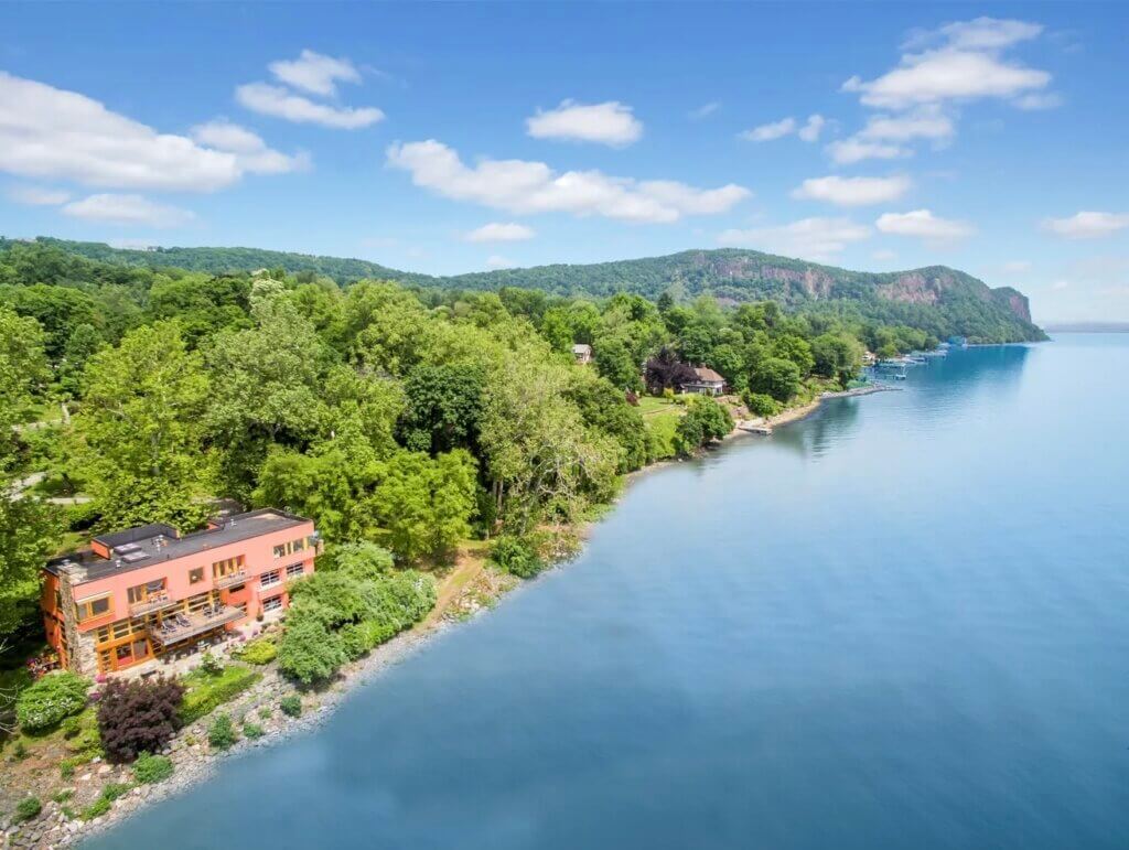
Long before Dutch settlers arrived, the wooded shoreline beneath Hook Mountain formed part of the homeland of the Munsee-speaking Lenape. The people who summered here fished the waters along the Bight near today’s Tappan Zee Bridge and gathered shellfish along the river. Well-established trails linked neighboring communities in the Hackensack River valley. One of those ancient paths eventually became today’s Old Mountain Road, while another path along the river evolved into North Broadway, at first known as the Road to the Hook. Together they form one of the oldest continuously used crossroads in the Nyacks.
The origin of the name Nyack has long been debated. Most historians today believe it was a Munsee word describing either a fishing place, or a point of land, both fitting descriptions of the shoreline beneath Hook Mountain. Long before there was a Dutch settlement, this landscape already had a history.
By the early 1670s, Dutch settlement was expanding northward from Manhattan into the lower Hudson Valley. Colonial officials encouraged that growth by issuing land patents, giving settlers legal title to occupy and improve specific tracts of land. As Dutch settlement increased, land clearing and farming disrupted the places Indigenous communities, had long used for food and seasonal settlement. By 1700 many Indigenous people in the area had moved west.
What Was a Colonial Patent?
A patent was a grant of land issued by a colonial government, giving an individual the legal right to settle a specified tract. Before a patent was issued, however, colonists generally negotiated a deed with the Indigenous people who occupied or claimed the land. Payment often consisted of trade goods such as cloth, tools, kettles, or wampum rather than cash. No Indigenous deed for the early Nyack patents is known to survive, so we do not know whether Claes Jansen negotiated directly with the local Lenape, what land they understood the transaction to encompass, or what payment may have been made.
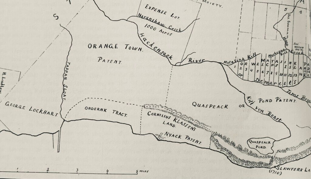
A patent did not always describe a neat rectangle. Boundaries were typically defined by streams, hills, marked trees, large rocks, neighboring properties, or other features that could be recognized on the ground. Such descriptions could be vague by modern standards. Indian Rock, the large glacial boulder on the ridge above Oak Hill Cemetery, served as one such early boundary marker. The surveyed line nearby still helps define the meeting of Nyack, Upper Nyack, and Valley Cottage as wells the division between Orangetown and Clarkstown.
Neighboring claims sometimes overlapped, patents were expanded through additional grants, and land was frequently bought, sold, or exchanged among settlers. Patents could also be an investment. Many of Rockland County’s patentees never settled on their land, rather they quickly resold it at a profit.
The earliest patents in the Nyacks are incompletely documented, and historians differ on some details of their boundaries and ownership. Despite these uncertainties, they established the framework for the farms and roads that eventually became the villages of Upper Nyack, Nyack, and South Nyack.
The Settlement Takes Shape
Among the earliest patentees was Claes Jansen van Purmerend (var.), a Dutch immigrant living in today’s Jersey City. In 1671, he received two adjoining patents in the Nyacks in return for an annual payment of six bushels of winter wheat to the colonial government. There is no evidence that he ever settled on the land.
More than a decade passed before permanent Dutch settlement began. In 1684, Claes’s Jersey neighbor Dowe Hermansen Tallman settled in the Nyacks, becoming the first known permanent Dutch settler. He had previously operated a trading post with the Indigenous people. Tallman acquired one-quarter of Claes’s November 20, 1671 patent and later additional land to the west, where he established a home and mills along Nyack Brook. His property became the nucleus of the settlement that eventually grew into the Village of Nyack.
When Claes died in 1688, his remaining Nyack lands passed to his eldest son, Cornelius Kuyper. Cornelius expanded the family holdings through inheritance, purchases, and additional grants. He later transferred the southern portion to his younger brother Jan (John) Kuyper, whose descendants became associated with present-day South Nyack, while Cornelius retained the northern lands that became Upper Nyack.
Together, the Tallman and Kuyper holdings helped establish the geography of the three villages that today share the name Nyack.
One of the few surviving documents from those formative years preserves that story. In 1694, six years after Claes Jansen’s death, his widow Annetje and his son Cornelius confirmed an earlier conveyance of one-quarter of the family’s November 20, 1671 patent to Dowe Tallman. Beyond recording the transfer, the document mentions Tallman’s house, the mill brook, the mill pond, and boundary trees, providing one of the earliest written descriptions of the settlement that became today’s Village of Nyack.


The Tallman Conveyance, 1694. Selected details from a certified copy of Dutch document records Annetje Jansen, and her son Cornelius Kuyper confirming the earlier transfer of one-quarter of Claes’s November 20, 1671 patent to Dowe Hermansen Tallman. Top: the original Dutch text; center: an English translation; bottom: Annetje and Cornelius’s names and seals. From Old Nyack.
Building a Life in Nyack
Born in 1659 in Ahasymus, now Jersey City, Cornelius Kuyper (whose Dutch surname was later Anglicized as Cooper) married Aetlje Tunise Bogert of Brooklyn in 1681. Their first several children were baptized in Brooklyn, providing evidence that the family’s move north occurred sometime later. Cornelius joined the Orange County militia in 1690, and the first Kuyper child baptized at Tappan appears in church records the following year. At the time, the Nyacks were part of Orange County; Rockland County would not be created from its southeastern portion until 1798. Cornelius and his family therefore probably settled between his father’s death in 1688 and his assumption of Orange County civic duties in 1690.
No document identifies the precise location of Cornelius and Aetlje’s home. One plausible site is near the junction of today’s Old Mountain Road and North Broadway, close to Upper Nyack Brook and the Hudson. The nearby burial ground, where Cornelius and Aetlje were later buried, strengthens the possibility but it does not prove that their house stood there.
The setting offered fresh water and easy access to the river and Indigenous trails. These were not roads in the modern sense. Much of the surrounding land remained wooded, and inland travel was probably made chiefly on foot or horseback. Tallman’s settlement lay about a mile to the south, but the Hudson offered the easiest means of carrying people, supplies, and farm products over longer distances.
Over the next three decades Cornelius and Aetlje had at least sixteen children. At least five died in infancy, a heartbreaking but common reality in colonial America. How Aetlje managed such an enormous household under these conditions is difficult to imagine today.
The 1702 Orange County census provides a remarkable glimpse into their lives. Cornelius and Aetlje were living with eleven children still at home, together with one enslaved man and two enslaved women, making it one of the largest Orange County households.

Life on a Hudson River Farm
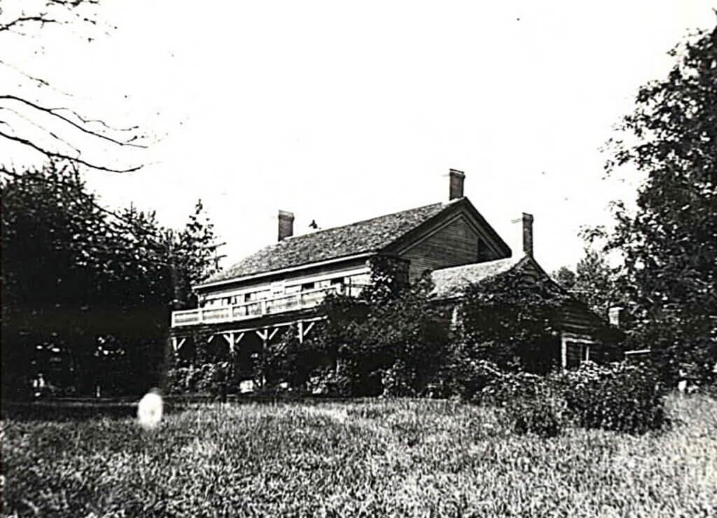
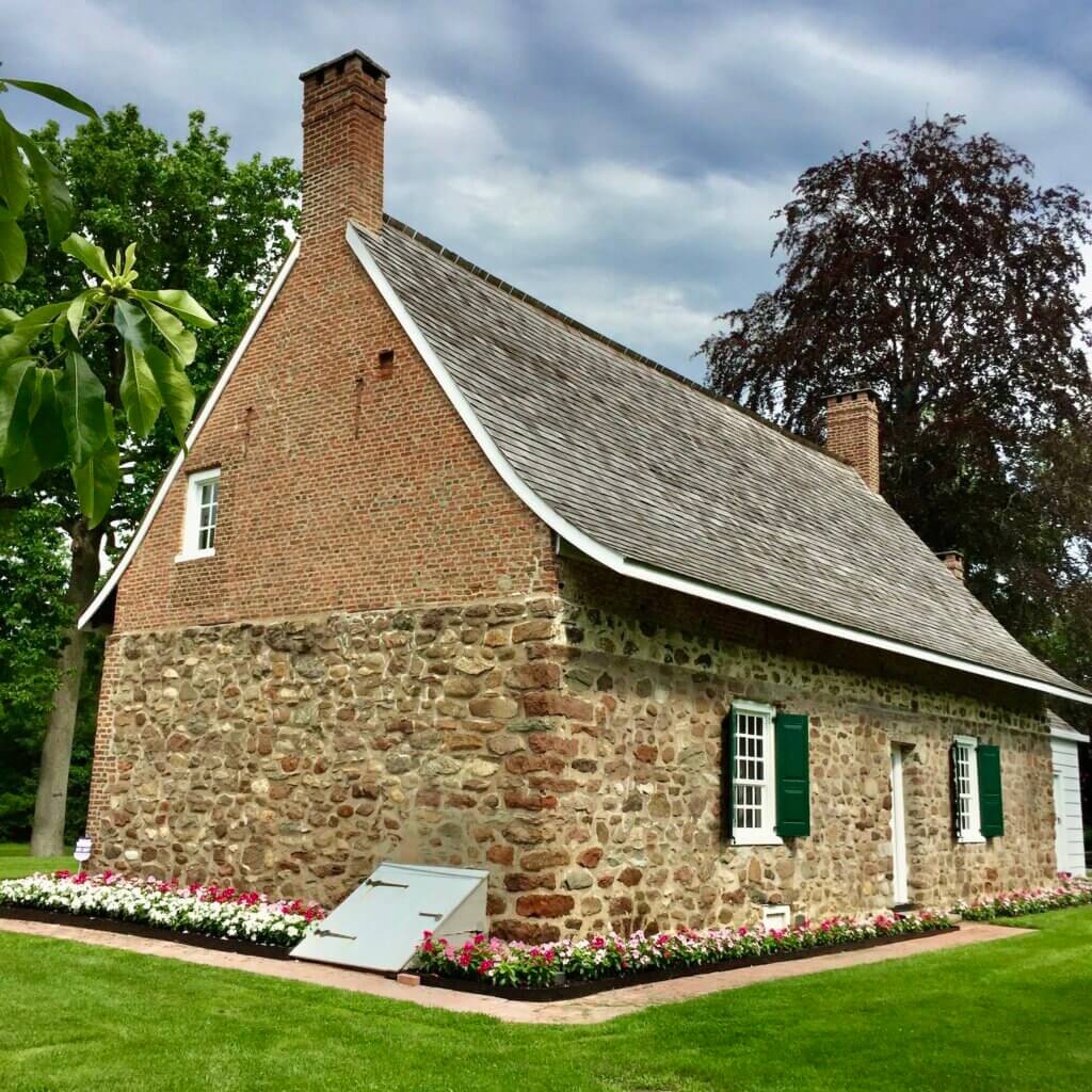
We do not know what the Kuyper home looked like. Early settlers sometimes began with temporary shelters made from sapling poles and bark or built partly into a bank. More permanent houses followed, often small, cabin-like structures constructed from rough sandstone slabs or field stones set in mortar. The Kuypers’ dwelling probably changed as the family grew and the farm became established, but no surviving document tells us when it was built, what materials were used, or how it was enlarged. The DeWint House in Tappan, first built around 1700 and later altered, offers a surviving example of Dutch colonial building traditions from the period.
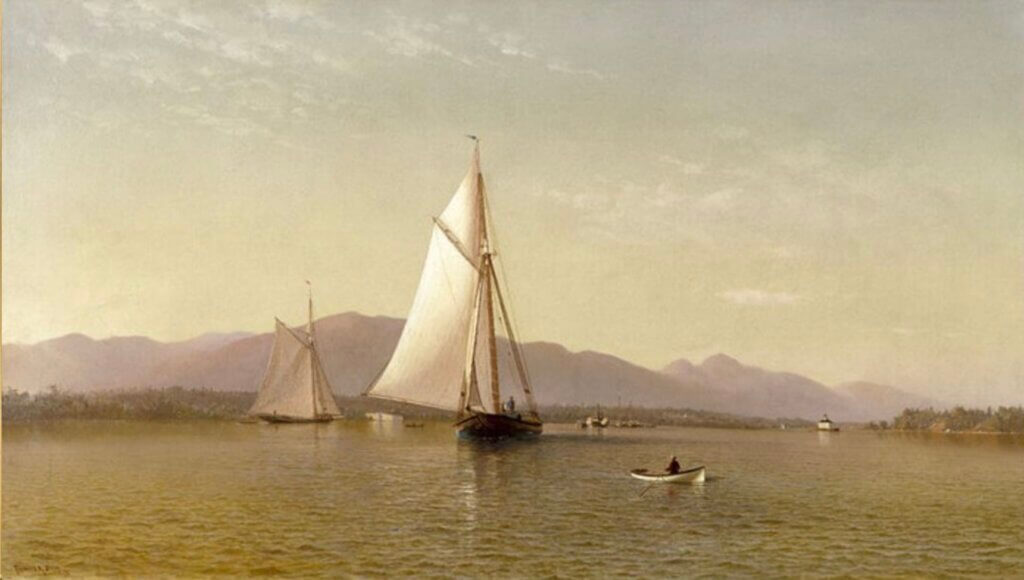
Like other Dutch families living and trading on the Hudson, the Kuypers undoubtedly depended on sailing vessels to carry people, crops, livestock and supplies. The family name itself reflected their traditional trade as coopers. Whether Cornelius owned a sloop is unknown, but these shallow-drafted sailing vessels, whose English name came from the Dutch sloep, had become essential to life on the river. Sloops connected farms with markets and neighboring communities
No record identifies a Kuyper landing, but the family’s riverfront location gave them ready access to the Hudson. Farm products could be transported to New York and exchanged for tools cloth, and other manufactured goods. For families like the Kuypers, the Hudson was their principal highway.
Running a farm of this size demanded constant labor. Family members worked alongside hired hands, indentured servants such as Philip Sarvent (who later bought the northern section of the property), and enslaved men and women who worked in the home, cleared fields, tended crops, cared for livestock, and maintained fences, barns, and buildings. Slavery was firmly embedded in this transformation of the colonial landscape.
From Farmer to Public Figure
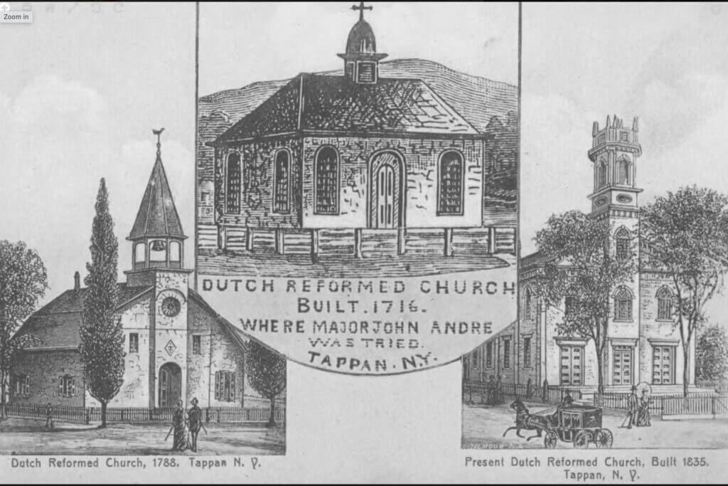
Cornelius’s influence eventually extended far beyond his Upper Nyack farm. He became an elder of the Reformed Church of Tappan in 1696, a position of considerable standing in the Dutch community. With overland routes still little more than Indigenous trails, the Kuypers may have found it easier to travel by water to the Tappan Slote, today’s Sparkill Creek, and continue from there to the church. In 1703, he was appointed a justice of the newly established courts of General Sessions and Common Pleas for Orange County. He became High Sheriff in 1708 and later represented the county in the colonial General Assembly.
Cornelius also continued to expand his landholdings. In addition to his property in the Nyacks and his share in the Tappan Patent, he acquired land in the nearby DeHarte and Kakiat patents.
The surviving records tell us almost nothing about Cornelius’s personality, but his actions reveal something of the man. He repeatedly acquired land, managed a large farm, traded along the Hudson, held a position of responsibility in his church, and rose through a succession of important county offices. By middle age, the son of a Dutch immigrant cooper had become one of the region’s most substantial landowners and public figures.
By the time of his death in 1731, Cornelius had expanded his inheritance left into landholdings in Orange County and beyond.
A Farm Becomes Three Villages
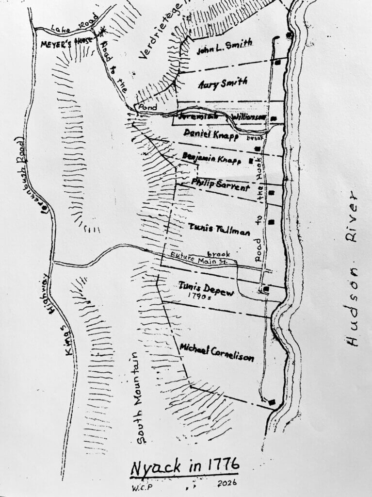
When Cornelius died in 1731, the large seventeenth-century tracts were already beginning the long process of subdivision. The three principal holdings associated with Cornelius Kuyper, his brother John, and the Tallman family would help define the later geography of Upper Nyack, South Nyack, and Nyack. Over succeeding generations, farms were divided into long strips running from the Hudson toward the western hills, then divided again as land passed through inheritance and sale.
By the time of the Revolutionary War, much of Cornelius’s Upper Nyack estate had passed out of direct Kuyper ownership. His former lands had been divided among several farms, while the South Nyack property associated with his brother John’s family eventually passed to Michael Cornelison in 1765. Yet the Kuyper connection had not entirely disappeared. A grandson, also named Cornelius Kuyper, served with the local Shore Guard during the Revolution.
The Old Palmer Burial Ground
Cornelius died in 1731, and Aetlje followed a few years later. They were buried in what is now known as the Old Palmer Burial Ground on Old Mountain Road, less than one hundred yards from the intersection with North Broadway and close to the area where their homestead may once have stood.
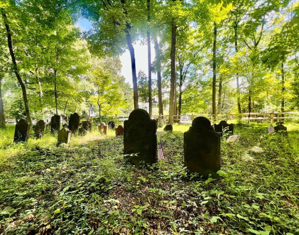
The cemetery remains one of the few places where the Kuyper story can still be experienced directly. Beneath mature trees stand their simple sandstone markers, each bearing only abbreviated inscriptions. Their weathered surfaces reflect the Dutch-speaking world in which Cornelius and Aetlje lived and raised their large family.
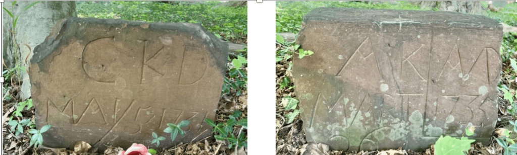
Cornelius and Aetlje Kuyper. Their simple sandstone markers bear abbreviated inscriptions typical of the period. Cornelius, bears only CKD, with D signifying his death. Aetlje’s reads AK, A/D, MART 1735 06 signifying the year of her death. The stones stand in the Old Palmer Burial Ground, probably established on Kuyper land near the family. Photos by the author.
Standing among the graves today, it is easy to overlook how completely the world around them has changed. The mature forests have largely disappeared, farm fields have become neighborhoods, and the Hudson no longer carries the commercial sloop traffic Cornelius would have known. Yet Old Mountain Road still follows an ancient route, North Broadway still runs toward Hook Mountain, and the boundaries of the three Nyacks retain traces of the farms established more than three centuries ago.
The Kuyper surname gradually disappeared from the Nyacks, but not entirely from the map. In the late twentieth century, a new residential street in Upper Nyack was named Kuyper Drive, reviving the name within the landscape where Cornelius and Aetlje had settled nearly three hundred years earlier.
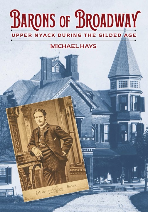
Just Published
Barons of Broadway: Upper Nyack During the Gilded Age
Available at Pickwick Books, Historical Society of the Nyacks, and Amazon
About the author
Mike Hays has lived in the Nyacks for 38 years. After a career as an executive at McGraw-Hill Education in New York City, he now focuses on researching, writing, and interpreting local history.
He serves as Treasurer and past President of the Historical Society of the Nyacks. He is also a Trustee of the Edward Hopper House Museum & Study Center and Historian for the Village of Upper Nyack. In these roles, he works with community partners to preserve historic resources and expand public understanding of the area’s past.
Since 2017, he has written the popular Nyack People & Places column for Nyack News & Views. The series chronicles the history, architecture, and personalities of the lower Hudson Valley.
Hays has also developed museum exhibitions, written interpretive materials, and led well-attended walking tours that bring Nyack’s history to life.
He is married to Bernie Richey. He enjoys cycling, history walks, and winters in Florida. You can follow him on Instagram at @UpperNyackMike.
Editor’s note: This article is sponsored by Sun River Health and Ellis Sotheby’s International Realty. Sun River Health is a network of 43 Federally Qualified Health Centers (FQHCs) providing primary, dental, pediatric, OB-GYN, and behavioral health care to over 245,000 patients annually. Ellis Sotheby’s International Realty is the lower Hudson Valley’s Leader in Luxury. Located in the charming Hudson River village of Nyack, approximately 22 miles from New York City. Our agents are passionate about listing and selling extraordinary properties in the Lower Hudson Valley, including Rockland and Orange Counties, New York.