One hundred and fifty years ago this month, Nyack faced a natural disaster of unprecedented proportions. A series of powerful storms struck the village in August 1875, leaving a trail of destruction. While floods are a recurring part of Nyack’s history, the Mega Flood of 1875 stands out as one of the most catastrophic, with water surging through the streets, damaging homes, buildings, bridges, and businesses.

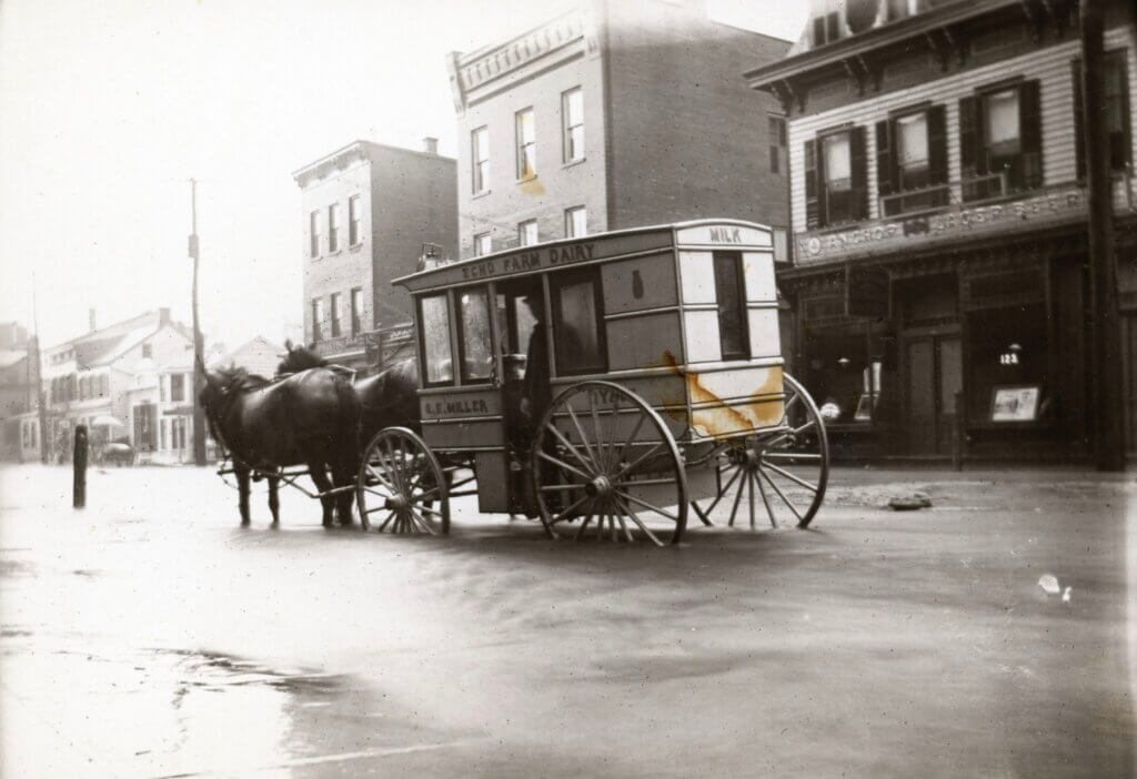
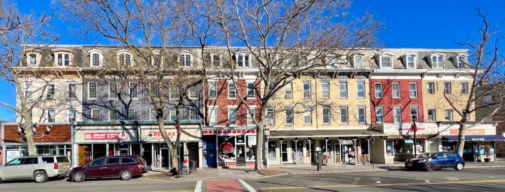
Nyack, at the time, was undergoing a dramatic transformation. From 1870 to 1890, the village experienced rapid growth as a bustling center for trade and industry. This period, marked by new construction, infrastructure, and commerce, saw the creation of many of the downtown buildings that still stand today. But this boom was met with a devastating force of nature—a reminder that even in the face of progress, the power of the environment remains a potent force.

The Storms of August 1875: A Prelude to Disaster
The story of the Mega Flood began on August 11, 1875, when a heavy rainstorm soaked the region, priming the ground for even worse conditions. Though the storm didn’t cause significant damage, it set the stage for the deluge that would follow just days later. On the afternoon of August 13, a relentless downpour turned Nyack into a river. The first wave of rain hit early in the afternoon, with torrents of water cascading down from the skies. The storm momentarily paused, leading villagers to believe the worst had passed. But by mid-afternoon, the skies darkened again, and a second wave of fierce rain followed, overwhelming the village’s drainage systems.
Within hours, Main and Burd Streets, and Depew Avenue became submerged under knee-deep water. The streets, once busy with the activity of a growing village, transformed into raging rivers, as floodwaters rushed downhill, tearing apart anything in their path. In less than a day, Nyack was unrecognizable, and the chaos had only just begun.


Main Street: Ground Zero of the Flood
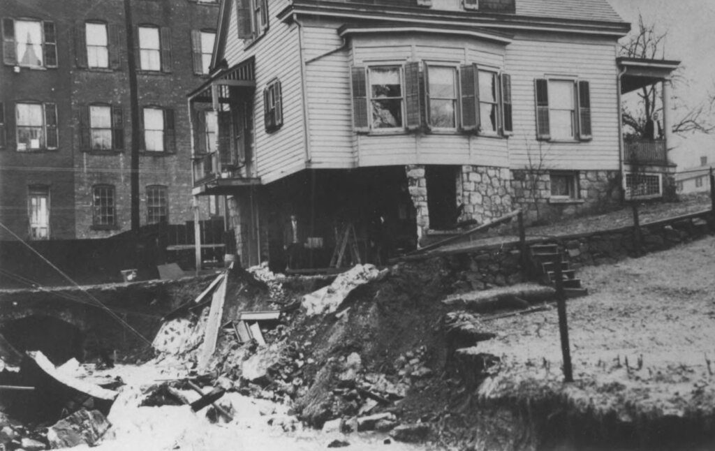
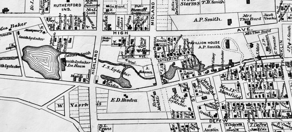
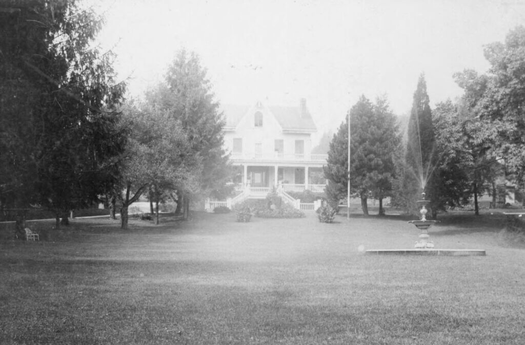
Main Street took the brunt of the devastation. Water surged through the streets, tearing apart the village’s infrastructure. The storm swept away or damaged bridges, including the one over Nyack Brook leading to Abram Smith’s resort, the Pavilion, which became impassable. The heavy waters upended flagstone sidewalks, flooded the basements of local businesses and homes, and submerged entire sections of town. The foundations of buildings, such as Meyer’s Meat Market and the house of J.R. Van Houten—located across from the Randolph Building (143 Main Street)—eroded, causing lasting damage.


The flood’s power was on full display, as water carved deep gulleys through front yards and completely washed away fences. At Ernst and Brothers the flood ruined the flagstone walkway and damaged the building’s structure. Towner’s marble yard at the corner of Main and Franklin had severe damage. Even the Onderdonk Block, a prominent part of the village, saw its basements flooded, highlighting just how widespread the destruction was.

Burd, Jackson, Depew: Streets Turned to Rivers
The flooding didn’t stop on Main Street. As the water surged through the village, it followed the course of the Nyack Brook and moved toward Burd Street where it loosened the bridge over Nyack Brook and damaged the plank walkway leading west. A large pond formed just to the north and west of Matthew’s Livery, and on Elm Street (now Jackson), basements flooded, and the streets became impassable for hours. Depew Street, too, was transformed into a rushing river, with water flowing towards South Broadway, and then continuing down Hudson Avenue toward Depew’s Bridge (today’s Arch Bridge over Nyack Brook) on Piermont Avenue.

Incredibly, Mrs. Elton’s confectionery on Depew, which had already flooded earlier in the week, suffered another flood. The land east of the Opera House on Depew Avenue had a pond four-feet deep.
South of the village, water carved massive gullies through the dirt streets, creating a dramatic and dangerous landscape.The storm carved out deep holes on Cedar Hill Avenue.
Local newspapers remarked that the flood could have been much worse if not for the dams that held back the full force of the water. Three dams—one at Highland Avenue, holding back Nyack Ice Pond, and two others along the brook by Main Street—prevented even greater damage. Still, the sight of water pouring over the ice pond dam was like a mini–Niagara Falls, and residents gathered in awe to witness the force of nature.

The Nyack and Northern Railroad: A Standstill
The flood also brought the local railroad to a halt. The Nyack and Northern Railroad, which served as a vital transportation link for the village, could not run that day due to the rising waters. This disruption further illustrated the extent of the devastation Nyack was facing.


The Second Storm: A Devastating Encore
As Nyack attempted to recover from the first storm, nature struck again. On August 18, another storm hit with even more fury, undoing much of the work done to clear up the aftermath of the previous flood. By 11 a.m., stores and cellars along Main, Burd, Jackson, Franklin, and Depew Streets flooded again. Once more, the streets became unrecognizable, and large gullies appeared where floodwaters had carved new paths. Flagstone walkways were damaged, and the railroad’s culverts and bridges were further eroded.
In Upper Nyack, lightning struck the old Palmer house on North Broadway, and a fire broke out. The Livermore family, who lived at Lochbourne next door, noticed the fire and alerted Garret Sarvent, who was seeking shelter in the Livermore gatehouse. Fortunately, Sarvent and his firemen were able to extinguish the flames, but lightning had already torn off part of the roof.

A History of Floods: Nyack’s Ongoing Battle with Nature


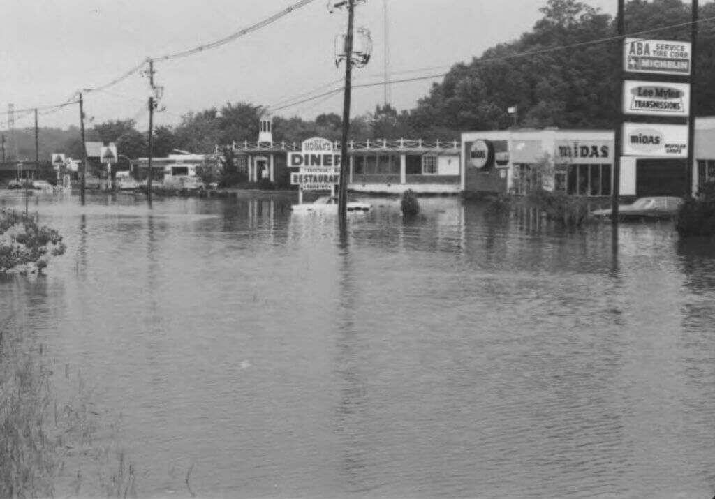
The Mega Flood of 1875 may have been the most dramatic, but it was by no means the first flood nor the last to affect Nyack. In fact, flooding has been a recurring theme throughout the village’s history. In 1845, a storm destroyed both the Depew and Hart bridges on Piermont Avenue. Other notable downtown floods followed, including those in 1903, 1942, 1948, 1954, 1960, 1969, 1999 (Hurricane Floyd), and the devastating flood of June 2011, when four inches of rain fell in just 30 minutes. These floods serve as a reminder of Nyack’s vulnerability to nature’s power and its ongoing struggle to balance growth with the unpredictable forces of weather.


Mike Hays lived in the Nyacks for 38-years. He worked for McGraw-Hill Education in New York City for many years. Hays serves as Treasurer of the Historical Society of the Nyacks, Vice-President of the Edward Hopper House Museum & Study Center, and Upper Nyack Historian. Married to Bernie Richey, he enjoys cycling and winters in Florida. He has written the Nyack People & Places column since 2017. You can follow him on Instagram as UpperNyackMike.
Editor’s note: This article is sponsored by Sun River Health and Ellis Sotheby’s International Realty. Sun River Health is a network of 43 Federally Qualified Health Centers (FQHCs) providing primary, dental, pediatric, OB-GYN, and behavioral health care to over 245,000 patients annually. Ellis Sotheby’s International Realty is the lower Hudson Valley’s Leader in Luxury. Located in the charming Hudson River village of Nyack, approximately 22 miles from New York City. Our agents are passionate about listing and selling extraordinary properties in the Lower Hudson Valley, including Rockland and Orange Counties, New York.