Hidden beneath streets and buildings, Nyack Brook still flows. In a few places, it breaks through, offering rare glimpses of a lost landscape.
What if a clear, spring fed brook still ran through downtown Nyack, lined with grass, filled with fish, and fully visible?
It once did.
☞ “The trout season has begun. Our boys who have nothing better to do had better sit on the Depew Avenue bridge, with line and hook, and see what they can catch in the brook—whether trout, ‘killy,’ or dead cat.” ***
Rockland County Journal, March 25, 1876
Even then, the brook was no trout stream.
Nyack Brook, originally known as Mill Brook, powered early industry. It fed a sawmill and a grist mill. It supplied an ice pond. Then, beginning in the 1850s, the village began burying it. Developers, builders, and engineers enclosed, rerouted, and built over most of its winding course to the Hudson River.
As a result, the brook disappeared from view and from memory.
Even underground, the brook asserts itself. During heavy rains, it periodically surges beyond its enclosed channel and floods nearby streets and properties. Whether enclosure reduced or intensified that flooding remains uncertain. What is clear is that the brook still behaves like a natural stream, even when confined.
Yet it never went away.
Today, small fragments still surface across the village. Some appear suddenly. Others sit below grade or hide behind fencing. Together, they reveal a lost landscape beneath Nyack’s streets.
These five locations offer rare glimpses of the brook as it once was and hints of what still survives.

The brook runs through the village to the Hudson River. Even then, a few buildings already straddle its course. Courtesy of the Nyack Library.
Walgreens Parking Lot
The stream drops six feet before slipping under pavement. Photo by the author.
At first glance, nothing suggests a buried stream. Then, at the northwest corner, the ground drops sharply to the parking lot pavement level.
There, Nyack Brook appears.
Water falls roughly six feet from the surrounding grade into a narrow channel. In summer, dense knotweed crowds the banks. The stream moves quickly through this confined space before vanishing again beneath pavement.
The setting feels accidental, almost like a tear in the village surface.
Nearby, a marker references the Underground Railroad. Some suggest the brook served as a boundary or guide. That claim remains uncertain. Still, the exposed channel hints at how visible and useful the brook once was.
The Ice Pond and Skating Pond
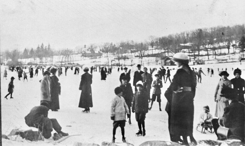
Fed by the brook, the pond supported ice harvesting before becoming a winter gathering place. Courtesy of the Nyack Library.
Just uphill, the brook once widened into an ice pond created in the 1870s.
Spring fed water filled a rock-lined basin. Each winter, workers cut blocks of ice and stored them in sheds along what is now Route 59. Over time, the pond became known as the skating pond.
By then, the brook had already been reshaped. Developers and engineers redirected its flow into a constructed channel that replaced parts of its earlier course. Even at this early stage, the natural stream had begun to disappear.
Local memory adds another layer. Tobias Justrich reportedly operated a sluice gate here to regulate water levels and reduce flooding. After his death in the 1930s, the system fell into disuse. Flooding increased.
Eventually, development erased the pond. Crews drained it, filled the land, and built over the site. The Thruway later cut through the area.
Today, nothing remains visible.
Mill Street: The Old Sawmill Site

One of the clearest visible stretches, the brook runs between steep banks before disappearing again. Photo by the author.
Here, Nyack Brook opens briefly along Main Street at Mill Street.
For a short stretch, the stream runs between steep banks and passes under small bridges at either end. In places, a concrete base replaces the natural bed. Even so, the water remains active and visible, one of the clearest views in the village.
This is where the Tallman family built an early sawmill, giving Mill Street its name. Streams of this size provided reliable power for small industry. The mill operated into the late 19th century, supplying lumber and later kindling.
Just uphill stood the Pavilion, a mid-19th century resort hotel. Guests gathered on its veranda to take in the Hudson River and the brook flowing below. Both the hotel and the mill disappeared by the early 20th century.
From here, it slips back under the buildings that line Main Street.

The Tallman mill stands over the brook, with the mill pond just above and the Pavilion on the hill. Courtesy of the Nyack Library.
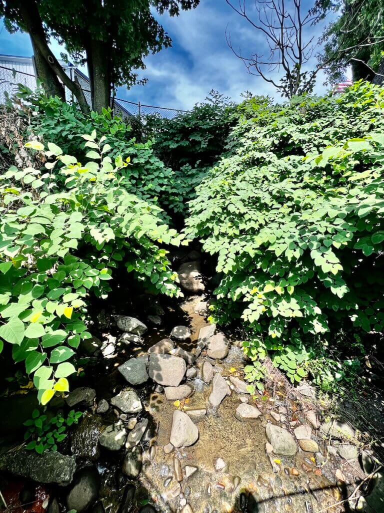
Nyack Community Garden

The stream runs below grade along a rocky channel, easy to miss despite its length. Photo by the author
Between Depew and Hudson Avenues, the brook emerges again, this time below grade and behind fencing.
The channel runs along a rocky bottom, bordered by a narrow strip of grass east of the Nyack Community Gardens. Because it sits well below street level, it is easy to overlook despite its length.
Still, this stretch feels more natural. Birds visit the water, and vegetation softens the edges.
This site once marked the end of the Northern Railroad line. A turntable stood nearby, allowing engines to reverse direction for the return trip south. Just across Depew Street, the old Opera House and hotel straddled the brook.
That entire landscape vanished during mid 20th century redevelopment.
The brook survived, but only as a hidden corridor.
Even now, it suggests what a continuous green thread through downtown once looked like.
Pavion and Strawberry Place

A stone lined channel controls the flow before the brook disappears beneath Broadway. Photo by the author.
At the Pavion apartments, the brook appears again, but in altered form.
A restored section curves through the property, lined with stone and engineered to control flow. The channel bends toward Broadway before disappearing once more beneath the street. It continues beneath Strawberry Place, where it can still be glimpsed through a rear window.
This stretch reflects a different phase of the brook’s history. For decades, industry crowded its banks. Carriage works, shoe factories, and sewing machine production all occupied this corridor. The stream often served as industrial waste drainage.
In the late 20th century, the site shifted again. Industrial use gave way to redevelopment. As part of that process, this section of the brook was uncovered and reshaped.
The result is controlled and contained, a designed version of a natural stream.
It offers visibility, but not restoration.
Memorial Park and the Arch Bridge
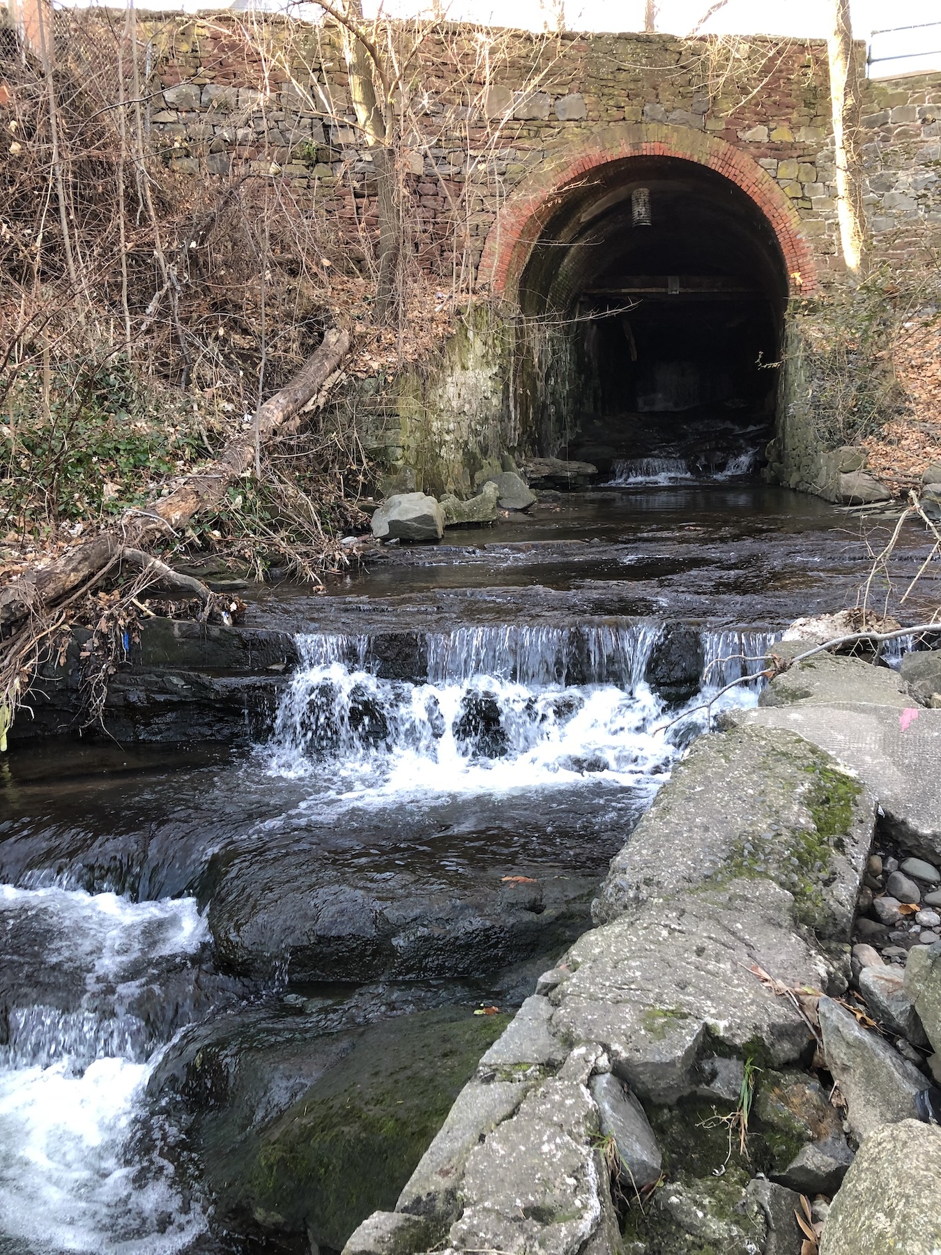
The brook passes beneath the 19th century arch bridge before entering the Hudson River. Photo by the Author.
At the southern edge of Memorial Park, Nyack Brook completes its journey.
In this stretch, the brook runs through an old sandstone quarry now covered over.
The stream passes under the historic Arch Bridge at Piermont Avenue before entering the Hudson River. During storms, water surges through the opening and echoes beneath the brick arch.
This site once formed the industrial heart of the brook. The Tallman and Depew grist mills stood nearby. Later, factories producing matches, wooden goods, and textiles occupied the same ground.
Fires, rebuilding, and eventual demolition reshaped the area. In 1920, the village cleared the industrial complex to create Memorial Park.
Even the land changed. Fill expanded the lower park during construction of the New York State Thruway, altering the brook’s final approach to the river.
At high tide, the Hudson pushes back into the channel. At low tide, the brook flows outward.
Here, at last, it is fully visible.
A Hidden Brook
Nyack Brook still runs beneath streets, buildings, and parking lots. In many places, it is fully enclosed. Entire sections lie under long established structures that make any meaningful restoration impractical.
Yet the water still moves.
It flows under Main Street. It passes unseen beneath blocks of development. Then, at a few scattered points, it surfaces—briefly reminding us that the village once formed around it.
The brook may be hidden, but it remains part of the village it helped create.
***Thanks to Mark Garrahan of Garnerville for bringing this 150-year-old Rockland County Journal quote to my attention via the Historical Society of Rockland County’s Flashback Friday post.
Mike Hays has lived in the Nyacks for 38 years. Following a career as an executive at McGraw-Hill Education in New York City, he now devotes much of his time to researching, writing, and interpreting local history.
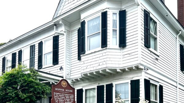
He serves as Treasurer and past President of the Historical Society of the Nyacks, a Trustee of the Edward Hopper House Museum & Study Center, and Historian for the Village of Upper Nyack. In these roles, he works closely with community partners to preserve historic resources and expand public understanding of the area’s past.
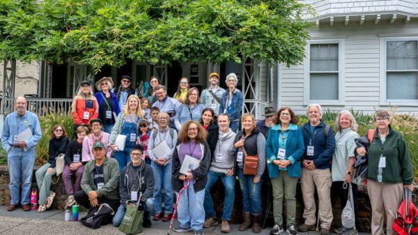
Since 2017, he has written the popular Nyack People & Places column for Nyack News & Views, chronicling the rich history, architecture, and personalities of the lower Hudson Valley. In addition, he has researched and developed museum exhibitions, written interpretive materials, and leads well-attended walking tours that bring Nyack’s layered history to life.
Married to Bernie Richey, he enjoys cycling, history walks, and winters in Florida. You can follow him on Instagram at @UpperNyackMike.
Editor’s note: This article is sponsored by Sun River Health and Ellis Sotheby’s International Realty. Sun River Health is a network of 43 Federally Qualified Health Centers (FQHCs) providing primary, dental, pediatric, OB-GYN, and behavioral health care to over 245,000 patients annually. Ellis Sotheby’s International Realty is the lower Hudson Valley’s Leader in Luxury. Located in the charming Hudson River village of Nyack, approximately 22 miles from New York City. Our agents are passionate about listing and selling extraordinary properties in the Lower Hudson Valley, including Rockland and Orange Counties, New York.